

· AFX Research
Why the APN and Legal Description Change an Environmental Search
The three ways a parcel gets identified, why only one of them matches what recorded instruments use, and what an incomplete order costs in accuracy and turnaround.
Table of Contents
The order form asks for a street address, a city, a county, a state, and an assessor parcel number. The address is the field everyone fills in and the parcel number is the field people skip, which is backwards from how the search actually works. Getting the property identification right at intake is the cheapest accuracy you will ever buy on an environmental lien and AUL search.
Three ways to name the same piece of land
A property has at least three identities, and they were created by different offices for different purposes.
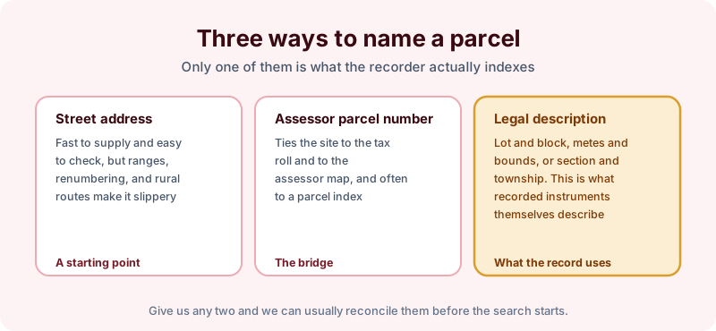
A street address is assigned by a municipality for mail and emergency response. It is easy to supply and easy to verify, and it is also the least stable of the three. Addresses get renumbered, ranges cover several parcels, and rural routes describe a mailbox rather than a boundary.
An assessor parcel number ties the site to the tax roll and to the assessor map, which makes it the bridge between an address and the land records. The recorded legal description is what the instruments themselves use. Lot and block in a platted subdivision, metes and bounds in older or irregular parcels, section township and range in public land survey states. When a deed restriction or an AUL is recorded against a property, that is the description it carries.
Why the mismatch matters
A researcher working from an address alone has to reconcile it to a parcel before searching anything indexed by parcel, and has to reconcile it to an owner before searching anything indexed by name. Both reconciliations can go wrong quietly.
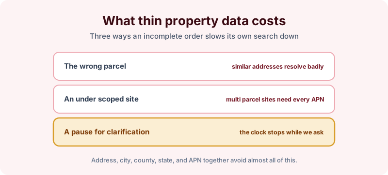
Similar addresses in the same county resolve badly more often than people expect, particularly on commercial corridors where several parcels share a frontage. Sites assembled from multiple parcels are the other common case. A facility that occupies four tax parcels is close to four searches, and an order that names one APN gets one parcel’s worth of coverage even though the assessment covers the whole site.
The third outcome is the one that hurts a deadline. When the details do not reconcile, the order pauses while we go back and ask, and the clock is not running on research during that pause.
What to gather before you order
Assembling this takes a few minutes and it removes almost every reason an order stalls.
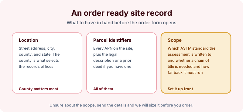
The county field deserves particular attention, because the county is what selects the records offices a search visits. Two towns with the same name in one state sit in different counties and pull entirely different repositories, and the set of offices searched is built from that.
If you have a prior deed for the property, sending it resolves the legal description question outright. It is the single most useful optional document at intake, because it carries the description in the same form the recorder holds it.
Two other details are worth flagging when they apply. A parcel that was recently split or combined may sit under a retired APN in filings only a few years old, so the current number alone can miss them. And a site that straddles a municipal or county line is two searches by definition, because the records offices on either side of that line are different offices with different indexes.
Scope belongs at intake too
Along with the property identification, say which ASTM standard the assessment is written to and whether a chain of title is needed. That determines whether the search runs from the current owner’s acquisition date or back to 1980, and whether an ownership history to 1940, 50 years, or 60 years is part of the order. Deciding it at intake is free. Deciding it after the report lands means a second order.
The takeaway
An environmental lien search is only as well aimed as the property description it starts from, and the parcel number and legal description are what connect an ordinary street address to the records that actually get searched. Address, city, county, state, and every APN on the site is enough to start almost any order cleanly. Start the order online, or send us the site details and a prior deed if you have one and we will reconcile the parcel before anything is ordered.